Updated 29 October 2026
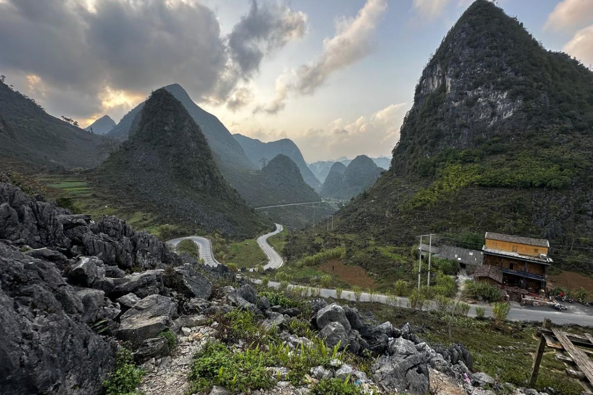
The Dong Van Stone Plateau is a limestone highland of about 2,356.8 square kilometers in Vietnam's far north, a UNESCO Global Geopark since 3 October 2010 and the winner of Asia's Leading Regional Cultural Destination 2025 at the World Travel Awards. It sits roughly 300 kilometers from Hanoi, at an average elevation of 1,400 to 1,600 meters, and is home to 17 ethnic groups. The practical point to know before you book: since 1 July 2025 the plateau has been part of Tuyen Quang province, not Ha Giang, and foreign visitors are being asked for a border-area permit to enter its northern communes.
Where is the Dong Van Stone Plateau, and is it still in Ha Giang?
The plateau is in the far north of Vietnam on the Chinese border, and since 1 July 2025 its official address is Tuyen Quang province — Ha Giang province no longer exists as an administrative unit.
Under Resolution 202/2025/QH15, Ha Giang and Tuyen Quang provinces merged into a single province called Tuyen Quang, with its administrative center in Tuyen Quang city. The new province covers 13,795.6 square kilometers with a population of about 1,731,600. The same reform abolished the district level across the country, so the four districts that made up the plateau — Quan Ba, Yen Minh, Dong Van and Meo Vac — are now communes reporting directly to the province.
Nothing on the ground changed. The road, the passes, the markets and the hotels are where they were. But airline forms, insurance documents and some booking systems now expect "Tuyen Quang", and older guidebooks will say "Ha Giang". Both names point to the same place. We explain the whole redraw in our guide to Vietnam's restructuring from 63 to 34 provinces.
Travelers still search for and talk about "Ha Giang", and so do we — it remains the name of the city you drive through and of the loop itself.
What makes it a UNESCO Global Geopark?
The plateau joined the UNESCO Global Geoparks Network on 3 October 2010 as Vietnam's first geopark and the second in Southeast Asia, and it has held the title through revalidations in 2014, 2019 and a third recognition marked on 29 October 2023.
The rock here is mostly limestone laid down in shallow seas, then lifted and dissolved into towers, sinkholes and bare pavements. Families farm in the pockets of soil between it, carrying earth by hand into hollows in the rock to plant corn — a technique called thổ canh hốc đá, farming in rock holes.
A UNESCO expert team completed a further revalidation inspection from 25 to 27 July 2026, visiting 34 geological, biodiversity and cultural sites across the geopark.
Do I need a permit to visit Dong Van and Meo Vac?
Foreign visitors travelling into the border communes of the plateau are being asked for a border-area entry permit, which tour operators and accommodations arrange on your behalf for roughly 200,000 to 250,000 VND per person.
The permit — giấy phép vào khu vực cấm, khu vực biên giới — applies to the border zone covering Quan Ba, Yen Minh, Dong Van and Meo Vac, including Lung Cu, Lo Lo Chai and the Ma Pi Leng and Nho Que area. Vietnamese citizens are exempt. Operators have reported the requirement applying to all foreign visitors from 1 June 2026; the rule has not been published as a public government notice, so treat it as the practical standard rather than a settled regulation, and ask your operator in writing whether the permit is included. World Mate Travel includes the border permit in the price of our Ha Giang programs.
Applying in person takes 15 to 30 minutes at a local immigration or police office with your original passport, your visa if you hold one, cash, and the license plate number of any rented motorbike.
Separately, the geopark charges a conservation fee of about 30,000 VND per adult and 15,000 VND per child per night of your stay, usually collected by your hotel.
If you are still arranging entry to Vietnam itself, start with our guide to the Vietnam e-visa.
How do I get to the Dong Van Stone Plateau from Hanoi?
There is no airport on the plateau, so every route starts with about 300 kilometers of road from Hanoi to Ha Giang city, then a further four to five hours north on Highway 4C to Dong Van.
| Option | Hanoi to Ha Giang city | One-way fare (VND) | Suited to |
|---|---|---|---|
| Sleeper bus, standard berth | 7–8 hrs | 250,000–350,000 | Budget travelers happy with an overnight berth |
| Sleeper bus, VIP cabin | 7–8 hrs | 380,000–480,000 | Solo travelers wanting a private cabin |
| Limousine van (9–11 seats) | 6–7 hrs | 350,000–450,000 | Couples and small groups |
| Private car, 4-seat | 5.5–6.5 hrs | 3,800,000–4,500,000 | Families, older travelers, flexible stops |
| Private car, 7-seat | 5.5–6.5 hrs | 4,500,000–5,500,000 | Groups with luggage |
Rain, fog or weekend traffic adds one to two hours to any of these. The second leg, Ha Giang city to Dong Van over Quan Ba and Yen Minh, takes four to five hours of mountain driving with photo stops — it is not a distance problem, it is a bends problem.
What are the main sights, and what do tickets cost?
The plateau's landmarks sit along a single north–south route, so a well-planned trip sees all of them without backtracking. The prices below were published by local operators in January 2026; confirm them on the day, as small site fees change without notice.
| Sight | What it is | Ticket (VND) |
|---|---|---|
| Quan Ba Heaven's Gate & Twin Mountains | First viewpoint onto the plateau, about 45 km from Ha Giang city | Free viewpoint; parking 10,000–50,000 |
| Vuong Family Mansion, Sa Phin | 64-room, 1,200 sqm residence of Hmong leader Vuong Chinh Duc, eight years in the building, a national relic since 1993 | 20,000 |
| Lung Cu Flag Tower | Vietnam's northernmost flag point | Adult 25,000 · child 15,000 |
| Dong Van Old Quarter | Early 20th-century stone and timber shophouses around the old market | 20,000 |
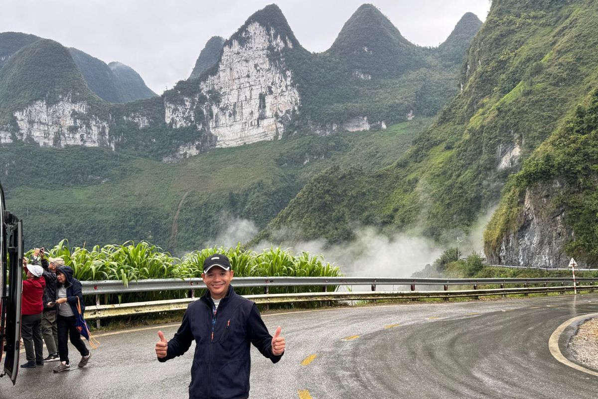
| Ma Pi Leng Pass | 20 km of Highway 4C between Dong Van and Meo Vac, cresting around 1,500 m | Free; parking at viewpoints |
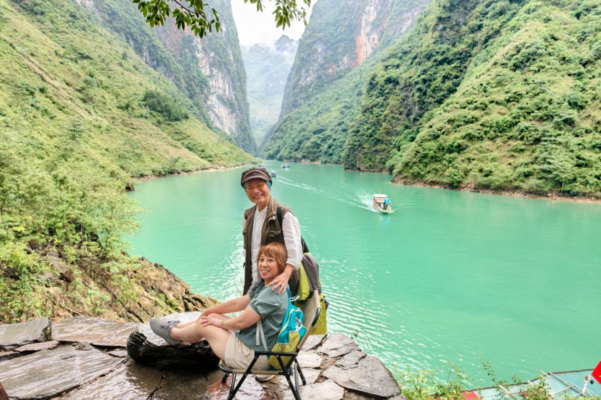
| Nho Que River boat trip, Tu San canyon | 45–60 minutes on green water between near-vertical cliffs | Shared boat 100,000–150,000 · private boat about 500,000 |
Ma Pi Leng is the centerpiece. It forms part of the Happiness Road, 184 kilometers of Highway 4C built between 1959 and 1965 by youth volunteer brigades — more than 1,300 volunteers and over 1,000 local laborers — much of it cut by hand into the cliff.
When is the best time to visit?
October and November are the strongest months: dry air, long views and buckwheat flowers across the plateau.
| Period | Conditions | What it is good for |
|---|---|---|
| March–April | Mild, mostly clear, occasional showers | Plum and pear blossom, green terraces, fewer visitors |
| May–August | Warm and wet; heaviest rain July–August | Full green landscape; landslide and fog risk on passes |
| September | Rain easing, ripening rice | Golden terraces at Quan Ba and Hoang Su Phi |
| Mid-October–mid-November | Dry, cool, clear | Peak buckwheat bloom and the clearest views of the year |
| December–February | Cold, damp, heavy fog; near-freezing nights at altitude | Cloud seas and quiet roads, but views are a gamble |
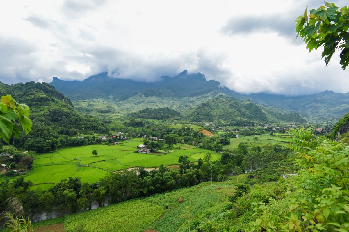
Buckwheat flowers open white in late September, turn pink through October and November and deepen to red by December, with the fullest color between mid-October and mid-November. The Buckwheat Flower Festival is normally held in mid to late November around Dong Van; dates are announced locally each year. For a national view by region, see our guide to the best time to visit Vietnam.
Which market days are worth planning around?
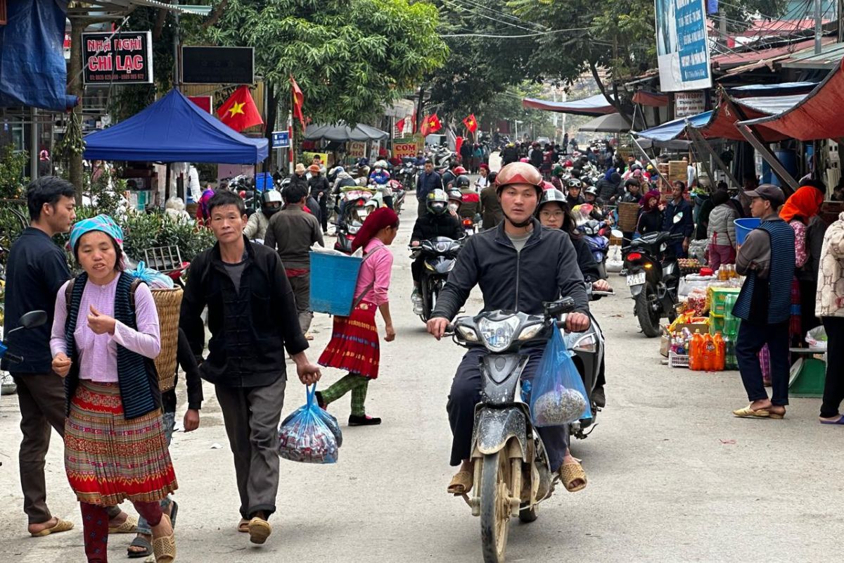
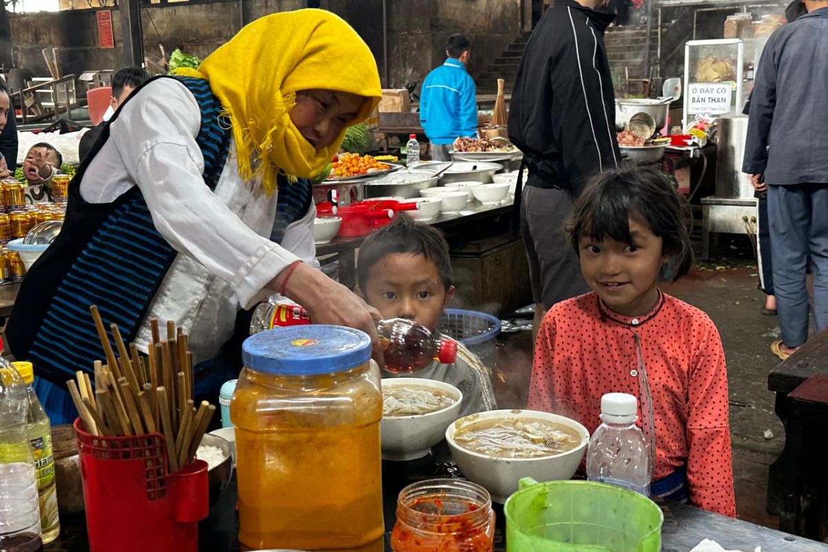
Market day is the plateau's best cultural experience, and most of the big ones fall on Sunday, so build your itinerary backwards from that.
| Market | Day | Where |
|---|---|---|
| Dong Van | Sunday | Beside the Old Quarter, Dong Van |
| Meo Vac | Sunday | Meo Vac center, strongest for livestock |
| Quan Ba | Sunday | Central market hall, Tam Son |
| Du Gia | Friday | Du Gia commune center |
| Sa Phin | Rotating — moves back one weekday each week | Near the Vuong Mansion, 15 km from Dong Van |
| Khau Vai Love Market | Once a year, 26th–27th day of the third lunar month | Khau Vai, about 30 km from Meo Vac |
Highland markets start around 05:00 and thin out by 10:00. Arriving at 09:30 means arriving at the end.
How many days do I need on the plateau?
Three days and two nights is the practical minimum from Hanoi; four or five gives you the plateau at the pace it deserves.
| Length | Route | Trade-off |
|---|---|---|
| 3 days / 2 nights | Hanoi – Ha Giang – Dong Van – Meo Vac – Hanoi | Covers the landmarks; two long driving days |
| 4 days / 3 nights | Adds a night in Ha Giang city or Yen Minh | Shorter daily drives, time for a market |
| 5 days / 4 nights | Adds Du Gia or Hoang Su Phi terraces | Village time, walking, photography |
| 8–9 days | Plateau combined with Cao Bang, Ban Gioc Waterfall and Lang Son | The full northeast circuit |
A day trip is not possible. Even by private car, Hanoi to Dong Van and back is more than 20 hours of driving.
Local tip from our guides
- Book the Nho Que boat for the morning. Afternoon wind pushes chop up the canyon and the light flattens. The road down to the landing is steep — your driver drops you at the top and a local shuttle covers the last stretch.
- Carry cash in small notes. Entrance fees, parking, boats and market stalls are cash-only, and card acceptance is limited outside the larger hotels. Change money before you leave Hanoi — see our tips for exchanging money in Vietnam.
- Dress for 1,500 meters, not for Hanoi. The plateau runs 5 to 8°C colder than the lowlands and the wind on Ma Pi Leng is constant. Bring a windproof layer even in summer.
- Ask before photographing people, especially at markets. A moment of eye contact and a nod is usually all it takes, and it changes the whole encounter.
Frequently asked questions
No. Hanoi to Dong Van is around 300 kilometers to Ha Giang city plus four to five hours of mountain road. The shortest workable trip is three days and two nights.
No. Every sight on this page is reachable by private car, and most of our clients travel that way. If you do want to ride, you need a Vietnamese license or a 1968 Vienna Convention international driving permit, and many travelers hire a local rider instead.
Yes, with a private vehicle and a relaxed schedule. The drives are long and winding rather than difficult, and the main viewpoints need little walking. Lung Cu Flag Tower involves a stair climb that can be skipped.
No. There is no commercial airport serving the plateau. International visitors fly into Hanoi Noi Bai and continue by road.
They are different. The geopark conservation fee is about 30,000 VND per adult and 15,000 VND per child per night, usually added to your hotel bill. The border-area permit is a separate document for foreign visitors, around 200,000 to 250,000 VND per person.
Layers, a windproof jacket, proper walking shoes for wet limestone, and a power bank. Nights are cold from November to February, and fog can sit on the passes for hours at a time.
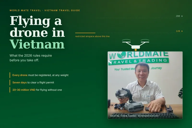
Not without permission. Drone flights in Vietnam's border areas require clearance from the provincial military command, and the plateau is a border zone throughout. Ask your operator well before departure.
Plan your Dong Van trip with World Mate Travel
We have been running private tours on this plateau for years, and our programs include the border permit, a licensed English-speaking guide, a private vehicle sized to your group, and the Nho Que boat — so market days and viewpoint timing are planned around you rather than around a bus schedule.
Tell us your dates and how long you have, and we will send a private itinerary built for your pace. WhatsApp +84 988 660 505 or email sales@worldmatetravel.com.
By David Ng, CEO & Founder of World Mate Travel & Trading Co., Ltd., licensed Vietnam tour guide with 25 years of experience.